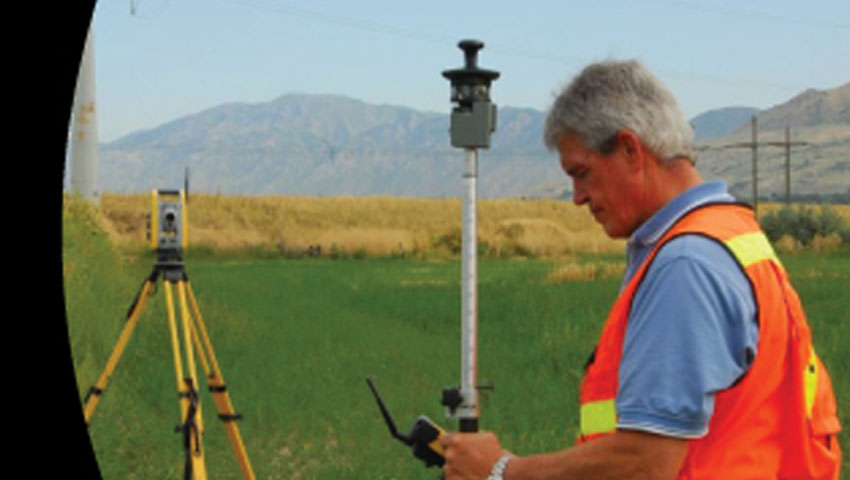
Boundary Consultants Professional Land Surveyors uses the best GPS equipment in the business to locate features above the surface of the Earth. GPS software uses satellites that uses geometry to find the position of an object down on Earth. The user will receive both coordinates and measurements of their requested distance on their GPS receiver.
Here at Boundary Consultants, we know how to correctly and efficiently use GPS tools to locate the position of an object or objects on Earth's surface. All of our GEODETIC Surveys are performed with the utmost precision to give the client a quality product that they can be satisfied with. With years of experience performing surveys in the state of Utah we know how to get a job done right, on time and to perfection.
Here at Boundary Consultants, we know how to correctly and efficiently use GPS tools to locate the position of an object or objects on Earth's surface. All of our GEODETIC Surveys are performed with the utmost precision to give the client a quality product that they can be satisfied with. With years of experience performing surveys in the state of Utah we know how to get a job done right, on time and to perfection.
Contact Boundary Consultants for Your Next Project
To learn more about our geodetic survey services call us at 801-792-1569 or contact us. We have been performing land surveying services in Utah for over 25 years.
Due to our quality and attention to detail, we are the #1 choice in land surveyors. We are available for quick questions and can quickly accommodate you if you'd like a bid. Fill out our free evaluation form.